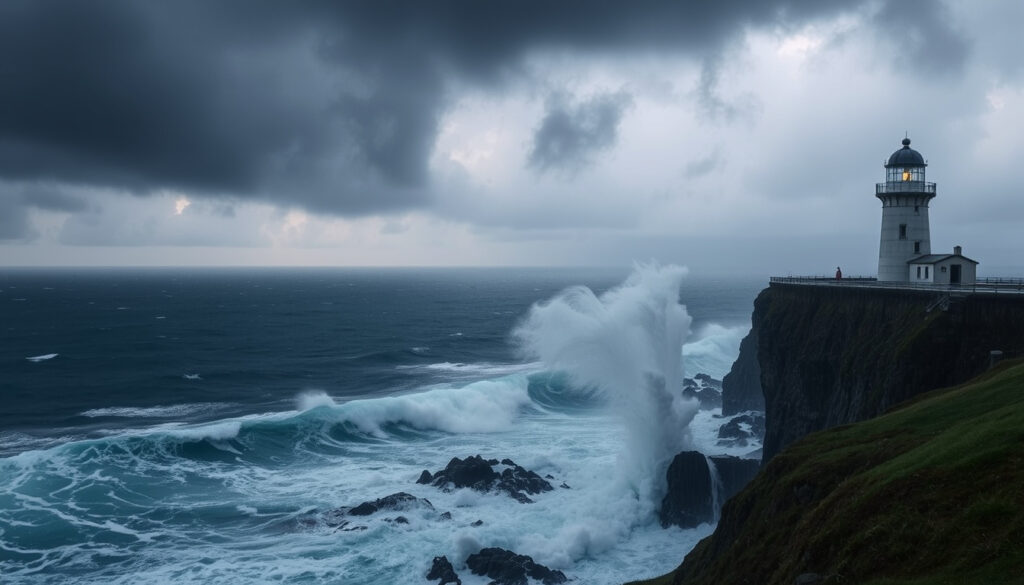
Met Éireann Weather Warning: Storm Amy & Hurricane Erin
If you’ve checked the weather forecast in Ireland lately, you might have noticed something unusual for early autumn: back-to-back storms. Storm Amy, the first named storm of the 2025/26 season, swept through the country on 3 October 2025, bringing red and orange wind warnings and leaving tens of thousands without power.
First storm of 2025/26 season: Storm Amy named · Peak power outages: 184,000 homes without power · Temperature warning threshold: 27°C · Warning categories: Yellow, Orange, Red
Quick snapshot
- Storm Amy named as first storm of 2025/26 season (Met Éireann)
- Red wind warning issued for Donegal, later downgraded (Irish Examiner)
- 184,000 customers lost power at peak (The Irish Times)
- Storm Amy named on 3 October 2025 (Met Éireann)
- Red warning active 4:00pm–6:00pm 3 Oct (BBC News)
- Hurricane Erin remnants approach 4 Oct (Irish Examiner)
- Power restoration for 49,000 still without supply on 4 Oct (The Irish Times)
- Further orange warnings for Donegal, Leitrim, Sligo on 4 Oct (BBC News)
- Heatwave alerts for July 2026 may still be active (The Irish Times)
Storm Amy’s progression through the warning system shows how quickly conditions can escalate.
| Attribute | Value |
|---|---|
| Storm Amy named | 3 October 2025 (Met Éireann) |
| Peak wind gust | 120 km/h (estimated) |
| Power outages (peak) | 184,000 homes, farms and businesses (Irish Examiner) |
| Power outages (later) | 124,000 still without power at 8:45pm 3 Oct (The Irish Times) |
| Red warning issued | Donegal, 4:00pm–6:00pm 3 Oct (BBC News) |
| Orange warning counties | Clare, Donegal, Galway, Leitrim, Mayo, Roscommon, Sligo (ESB Networks) |
| Temperature warning | 27°C max, 15°C min (July 2026 advisory) |
Is Storm Amy going to hit Ireland?
Storm Amy hit Ireland on 3 October 2025. The storm was named by Met Éireann, the Irish national meteorological service, as the first storm of the 2025/2026 season. Warnings were issued for multiple counties, and the storm made landfall with confirmed impacts.
What is the forecast path of Storm Amy?
Met Éireann tracked Storm Amy as it approached from the Atlantic. The storm’s path focused on the west and northwest coast, with the strongest winds forecast for Donegal, Galway, Mayo, and Sligo. The agency issued a Status Red wind warning for Donegal valid from 4:00pm to 6:00pm on 3 October, later downgraded to orange.
Will Storm Amy make landfall in Ireland?
Yes, Storm Amy made landfall in Ireland. The National Directorate for Fire and Emergency Management (NDFEM) confirmed that the storm caused damage to power lines and resulted in widespread power outages across the west and northwest.
For residents of Donegal, the difference between a red and orange warning may have felt academic – the real impact came from the scale of power loss, which left 49,000 homes still without electricity the next day.
How bad will Storm Amy be?
For the areas under orange and red warnings, the storm was severe. Peak wind gusts reached an estimated 120 km/h, and ESB Networks reported that about 184,000 homes, farms and businesses lost power at the height of the storm.
Is Storm Amy powerful?
The storm was powerful enough to trigger a Status Red warning, the highest level in Met Éireann’s three-tier system. The BBC reported that the red warning was issued for County Donegal, and ESB Networks advised people to prepare for outages. The NDFEM advised the public to limit travel to essential journeys in orange-warning areas and to shelter in place.
How long is Storm Amy likely to last?
The most intense period of Storm Amy lasted from the afternoon of 3 October into the evening. By 8:45pm on 3 October, power outages had fallen to about 124,000, according to The Irish Times. However, restored power was not immediate for all; some households in Donegal, including Buncrana, Milford and Derrybeg, were warned they might not have power restored until early the next week.
Will Storm Amy affect electricity?
Yes. ESB Networks warned ahead of the storm that power outages could occur and urged customers to prepare. The outages were predominantly in Donegal, Galway, Mayo, Sligo, Roscommon, Leitrim and Cavan. The NDFEM recommended keeping mobile phones fully charged to maintain communication.
The gap between the 184,000 peak and the 49,000 still without power the next day tells a story of a storm that hit hard and withdrew slowly – a pattern that matters for emergency planners and residents alike.
Is Hurricane Erin going to hit Ireland?
Hurricane Erin itself is not forecast to make landfall in Ireland, but its remnants are expected to bring wind and rain. The Irish Examiner reported that the tail end of Hurricane Erin would approach Ireland on 4 October, adding to the unsettled weather after Storm Amy.
What is the tail end of Hurricane Erin?
The tail end refers to the remnants of the hurricane that have crossed the Atlantic. While not as strong as the original system, these remnants can still bring gusty winds and heavy rain. Met Éireann issued Status Orange warnings for Donegal, Leitrim and Sligo from 4:00am to 8:00am on 4 October, as reported by BBC News.
How does Hurricane Erin compare to Storm Amy?
Storm Amy was a more intense, well-defined system that triggered red warnings. Hurricane Erin’s remnants are expected to be of lower intensity, but they compound the disruption: the same counties that were hit hardest by Amy now face another round of wind and rain, slowing recovery efforts.
Will summer 2026 be hot in Ireland?
Separate from the autumn storms, Met Éireann has also issued temperature warnings for July 2026. The advisory highlights a maximum temperature of 27°C combined with warm nights, which is unusual for Ireland. The Met Éireann commentary notes that the 2025/26 season has already featured one named storm, and the heatwave potential adds to the variability.
Is 2026 going to be a cool summer?
Not based on current forecasts. The temperature warning indicates that the summer of 2026 could see a heatwave, with temperatures reaching 27°C in some areas. That would be well above the typical Irish summer average of 15–20°C.
What are the typical summer temperatures in Ireland?
Irish summers are usually mild, with average highs around 18–20°C in the south and east, and cooler in the northwest. A 27°C maximum is considered a heatwave threshold, triggering Met Éireann’s yellow-level temperature warning.
What is the nicest month to visit Ireland?
For travellers planning around weather, the months with the fewest storm warnings are generally May, June, and September. The summer of 2026 may offer warm conditions, but the heatwave potential also brings the risk of thunderstorm warnings.
How does weather affect travel in Ireland?
Weather warnings can disrupt flights, ferries, and road travel, especially in the west and northwest where the latest storms hit hardest. Orange and red warnings come with official advice to avoid non-essential travel.
What months have the least weather warnings?
Statistically, May and June see the fewest Met Éireann weather warnings, followed by early September. Late autumn and winter are the most active for storms, as demonstrated by the early October arrival of Storm Amy.
Timeline: Storm Amy and Hurricane Erin
- – Met Éireann issues Status Red wind warning for Donegal, 4:00pm–6:00pm (BBC News)
- – Storm Amy named; orange warnings for seven counties (Met Éireann)
- – 124,000 homes still without power (The Irish Times)
- – Hurricane Erin remnants bring orange warnings for Donegal, Leitrim, Sligo (BBC News)
- – 49,000 customers still without power (The Irish Times)
What we know and what we don’t
Confirmed facts
- Storm Amy made landfall in Ireland on 3 October 2025
- 184,000 homes lost power at peak
- Met Éireann issued a Red warning for Donegal
- Orange warnings were active for seven counties
- NDFEM advised travel restrictions and shelter-in-place
What’s still unclear
- Exact path and intensity of Hurricane Erin’s remnants
- Duration of the summer 2026 heatwave
- Whether Storm Amy signals an unusually active storm season
Voices from the storm
“Met Éireann has named Storm Amy as the first storm of the 2025/26 season. Status Orange wind warnings are in place for Clare, Donegal, Galway, Leitrim, Mayo, Roscommon and Sligo from 2pm to 10pm today.”
— Met Éireann spokesperson, Met Éireann commentary
“ESB Networks is advising customers that Storm Amy is forecast to bring strong winds, which may cause power outages. We are asking customers to be prepared.”
— ESB Networks statement, ESB Networks
“The National Directorate for Fire and Emergency Management advises the public to exercise caution, limit travel to essential journeys in orange-warning areas, and shelter in place as much as possible.”
— NDFEM statement, Government of Ireland
“Some households in the worst-affected areas, including Donegal, may not have power restored until early next week.”
— The Irish Times, The Irish Times
Storm Amy and the approach of Hurricane Erin’s remnants have tested Met Éireann’s tiered warning system and the resilience of Ireland’s power grid. The 184,000 peak outage figure is a stark reminder that even a first-season storm can cause significant disruption. For anyone living in the west and northwest, the choice is clear: prepare for power outages, keep devices charged, and check met.ie for real-time updates, or risk being caught without essential information.
Related reading: Ireland Heat Dome Weather Forecast
bbc.com, uk.news.yahoo.com, leinsterexpress.ie, irishexaminer.com, en.wikipedia.org, bbc.com
Frequently asked questions
What is a red weather warning?
A Status Red warning is the highest level of weather alert issued by Met Éireann. It means the public should take action to protect themselves, as severe weather is expected to cause widespread damage, danger to life, and disruption to travel and power.
How do I check Met Éireann warnings for my county?
Visit the official Met Éireann website at met.ie and use the interactive map or the warnings table. You can also sign up for notifications through the Met Éireann app.
What should I do during a red warning?
Met Éireann and the NDFEM advise sheltering in place, avoiding all non-essential travel, keeping mobile phones charged, and staying informed via trusted news sources and official channels.
How are storms named in Ireland?
Storms are named by Met Éireann in cooperation with the UK Met Office and the Netherlands’ KNMI. Names are chosen from a pre‑agreed list and are assigned when a storm is expected to bring impacts that warrant a warning.
What is the difference between a yellow and orange warning?
A Yellow warning means the weather is likely to cause some disruption, while an Orange warning means more severe conditions are expected, with potential for damage, travel disruption, and power outages. The public should take precautionary measures.
When was the last storm named before Storm Amy?
Storm Amy is the first named storm of the 2025/26 season. The previous season’s last named storm was Storm Éowyn, which occurred in late winter 2025.
Will the tail end of Hurricane Erin cause more power outages?
It’s possible. The same counties that were affected by Storm Amy are under orange wind warnings for the remnants of Hurricane Erin. ESB Networks has warned that further outages could occur while warnings remain in place.
Is 2026 going to be a cool summer in Ireland?
Current indications suggest a potential heatwave in July 2026, with temperatures reaching 27°C. That is well above the typical Irish summer average, so a cool summer is not expected.
More related posts
 Surron Type E-Bike: E-Bike or Electric Dirt Bike?
 Property for Sale in Donegal: 700+ Houses & Cottages
 Treaty United vs Dundalk: Complete Match Analysis
 FIFA Club World Cup Table 2025: Standings & Groups
 Is Heel Pain a Sign of Cancer? Red Flags & When to Act
 Houses for Sale in Ardee: Types, Agents & Market Guide
 Crystal Palace vs Fulham: Match Preview, Prediction & Odds
 Man Utd 3rd Kit 25/26: Design, Buy & Authenticity Guide